
Hey, why don’t you take a hike?! Don’t worry, we’re not telling you to get lost. We want you to explore the plethora of remarkable hiking trails throughout the Garden State! National Take a Hike Day may officially be November 17, but now is the time to get outside before winter rolls in.
For those who do want to hit the trails this week, we’ve got some great tips for places to check out by region.
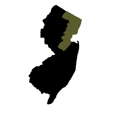
Skylands Region
Sussex, Morris, Hunterdon, Warren, Somerset counties
 The Skylands Region is home to rolling hills and endless acres of farmlands. It also boasts the highest point in New Jersey—aptly named High Point State Park in Sussex County. The park’s Monument Trail leads hikers up to a monument where the ambitious adventurer can climb the 220-foot structure for a 360 degree view. Part of the New Jersey section of the Appalachian Trail runs adjacent to park. (For more short but sweet Appalachian Trail hikes in Sussex and Warren counties, read our story, “Top of the World.”) In Warren County, Jenny Jump State Forest has 11 miles of hiking trails, including Summit Trail, which boasts views of the Delaware Water Gap on a clear day. Hikers can then continue to the Ghost Lake Trail to cross the forest’s Ghost Lake on the grass-covered causeway before nearing the northern end of the trail. At 6.6 miles long, the Black River Trails run from north to south in Morris County. From the north, start at the Cooper Gristmill in Chester and head south past Kay Environmental Center and through Hacklebarney State Park before arriving at the Bamboo Brook Outdoor Education Center where you can enjoy the perfectly pristine gardens surrounding the education center.
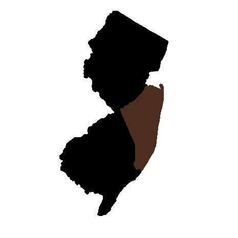
Gateway Region
Passaic, Bergen, Essex, Hudson, Union and Middlesex counties
 The Gateway Region is the most urban part of the state, but that doesn’t mean it offers less hiking than the state’s other regions. The best thing about hiking these parts is the potential for skyline scenery in the distance. With park access to Ramapo Mountain State Forest via Skyline Drive, it’s no surprise visitors might catch a glimpse of Manhattan on one of its seven trails. Just a few miles to the west, at Norvin Green State Forest, hikers can also spot the skyline at Wyanokie High Point after scrambling up roughly 9 miles of mostly rugged terrain. Heading southeast from Passaic County into Essex County, the skyline slowly becomes more visible. Eagle Rock Reservation, a 400-acre park along the Watchung Mountain Ridge Line, spans Montclair, West Orange and Verona. In addition to hiking and horseback riding trails, the park is home to a 9-11 memorial and overlook with views of the city skyline. At Palisades Interstate Park, a hiking destination steeped in history, the skyline finally comes into focus—mostly because it’s right in front of you. Hiking these dramatic cliffs to the west of the Hudson River is such a delight, you might forget you’re in Hudson County.
Delaware River Region
Mercer, Burlington, Camden, Gloucester and Salem counties
 The region, which encompasses five counties, borders the Delaware and includes part of the Pinelands—a National Reserve made up of more than one million acres of land and home to dozens of rare plant and animal species. Sourland Mountain Preserve—which remains mostly undeveloped due to its rocky soil—is a 4,000-acre tract of land which stretches from Somerset County into Mercer County. Its four trails with a combined 9 miles include boardwalks, bridges and boulders. Washington Crossing State Park, located in Mercer and Hunterdon counties, is a 3,500-acre park with Revolutionary War-era history and 15 miles of moderate trails. The 50-mile long Batona Trail, which stretches through the Pinelands, certainly cannot be tackled in one day, but with several major roads running through the trail, it’s easy to split up the hike. The trail starts in Brendan T. Byrne State Forest, passes through Wharton State Forest and ends in Bass River State Forest just west of the Garden State Parkway. A highlight is Apple Pie Hill—one of the highest points in the Pine Barrens, at 205 feet high. With the red and white fire tower at its summit standing 60 feet tall, it’s impossible to miss. To plan your route ahead of time and find more points of interest along the way like Atsion Recreation Area and historic Batsto Village, see the Batona Trail map here.
Shore Region
Monmouth and Ocean counties
 While the Shore Region does encompass more than half of New Jersey’s beaches, it’s also home to some great hikes. Hartshorne Woods Park is known for its extensive network of trails—almost 19 miles in just under 800 acres. The trails range in length from 0.6 to 3.4 miles and are categorized by their difficulty. For an easy to moderate hike on the lengthier side, check out the 6-mile Laurel Trail Loop. Best known as a restored historic village, Allaire State Park also has almost 20 miles of hiking trails. Of the park’s ten different trails, three leave from Allaire Village, where visitors can get a sense of the thriving industrial community of the past. In Ocean County, Cattus Island County Park has a few shore-front trails that anyone can enjoy. At 2.2 miles, the park’s Island Loop trail is the longest (and also open to cyclists). Another Ocean County park with even more trails is Wells Mills County Park in Waretown. With four main trails, ranging in length from 1.3 to 8.4 miles, there’s a path for every type of hiker.
Greater Atlantic City Region
Atlantic County
 Its claim to fame may be Atlantic City, but this southern New Jersey county isn’t all casinos and beaches. At Estell Manor Park there are more than eight miles of hiking trails, which include about 1.5 miles of boardwalk—not the amusement type—and a few miles of mountain bike trails, too. Don’t miss the ruins along the trails, including an 1800’s glass works industry and World War I munitions factories. At Edwin B. Forsythe National Wildlife Refuge, the Brigantine Unit Hiking trails allow visitors to enjoy the scenery and bird watch. The Leeds Eco-Trail offers a unique opportunity to view two different habitats: tidal salt marsh and maritime forest.
Southern Shore Region
Cumberland and Cape May counties

Situated between the Atlantic Ocean and the Delaware Bay, these southernmost New Jersey counties have a flat mix of sand and marshland terrain. That, of course, doesn’t allow for much elevated hiking in these parts—but there are two places to check out. At Belleplain State Forest, the 7.2-mile East Creek Trail can be strenuous in length, but mostly flat. At the Lake Nummy parking area follow the white markers to begin the hike, which will eventually loop back around to where you started. For an equally pleasant, but much shorter route, check out Maurice River Bluffs Preserve. The trail system, cared for and managed by the Nature Conservancy, is adjacent to the Maurice River and includes three different trails.
A good overview. For those who enjoy hiking with a group, The Highlands Nature Friends has guided hikes in the Ringwood area every other Saturday. http://www.highlandsnaturefriends.org/hiking.html
Nice article for finding trails in different regions of NJ, but I take issue with the statement that “The 50-mile long Batona Trail, which stretches through the Pinelands, certainly cannot be tackled in one day”. There’s this group (https://www.facebook.com/groups/219715258383854/) that meets up once a year to do just that. I joined them last year and it was a great time! Here is a write up about the experience: http://scottcsnell.blogspot.com/2016/11/the-batona-50-is-point-to-point-race.html