
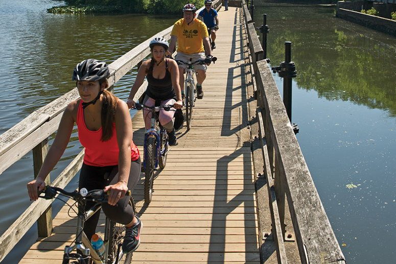
For the casual bicyclist, there’s nothing more relaxing than pedaling without fear of traffic. Lucky for us, New Jersey has an ample number of paved and unpaved bikeways along abandoned rail beds, canal paths and woodsy trails. All that’s required is a hybrid or trail bike (for the unpaved bikeways), helmet, snacks and water. All of these trails are relatively flat and great for family riding. Keep in mind that unpaved trails can be muddy after rainy periods.
Sussex Branch Trail
Lafayette to Andover (Sussex County)
Length: 9 miles one way
Surface: Gravel and dirt
The trail follows an old rail bed through forests and along lakes. Pick up the trail behind the Lafayette Mill Antique Center (Route 15 at Morris Farm Road). There’s plenty of parking here, plus the Millside Café for post-ride refreshments. Head south from the mill. After about 15 minutes, you’ll reach a break in the trail requiring a 1.1-mile ride on the narrow shoulder of Route 663 (Hicks Avenue). Traffic is sparse, but this is not the place for the youngest riders. After you return to the trail (on the left, just before the T intersection), you will cross Route 616 and plunge back into the woods. Just ahead is the Andover Slate Cut, a narrow passage through 20-foot-high rock walls. Breathe in the mossy ferment and enjoy the natural air conditioning. The trail continues south to Kittatinny Valley State Park, where you’ll find portable toilets and some serious mountain-bike trails. Head back from here; much of the rest of the trail is difficult to follow.—KS
Paulinskill Trail
Warbasse Junction to Hainesburg (Sussex County)
Length: 25 miles one way
Surface: Gravel and dirt
This woodsy, family-friendly ride is almost all flat. Start from the parking lot on Route 663 (just south of Route 94 in Lafayette). Much of the ride is on a raised rail bed; parts pass through dramatic slate cuts. About five miles into the ride, watch out for an abrupt detour where the bridge over Route 622 was washed out. Riding on, you’ll pass Paulinskill Lake. At the south end of the lake, there’s another missing bridge. Cross Route 614 and pick up the trail off Kohlbocker Road. Farther on, you’ll reach little Blairstown Airport, where you can watch the gliders in silent flight and grab a snack at Donna’s Runway Café. Pick up the trail south of the airport and continue to the massive (but graffiti-tainted) Hainesburg Viaduct. Turn back here; beyond this, the trail gets swampy. —KS
Saddle River Area Bike Path
Ridgewood to Rochelle Park (Bergen County)
Length: 7.5 miles one way
Surface: Asphalt
This paved corridor uses bridges and underpasses to avoid road crossings as it snakes through Bergen County. That makes for a safe, pleasant, mostly flat ride, suitable even for kids on trikes. It’s also a favorite of joggers and strollers. Start in the parking lot at Wild Duck Pond (Ridgewood Avenue) and proceed south through Dunkerhook Park, with its sprawling play area. Follow the signs to Saddle River. You’ll pass more play areas, a waterfall and a historic water wheel before reaching trail’s end in Saddle River County Park. —KS
Hudson River Waterfront Walkway
(Hudson County)
Length: 11.5 miles
Surface: Blacktop, brick
The pathway along the west bank of the Hudson eventually will run unbroken from Bayonne to the George Washington Bridge. For now, riders (and walkers) content themselves with this stretch from Liberty State Park to North Bergen. It’s flat and fine for family biking, although there are a few gaps that put riders in local traffic. The path swings around piers and through waterfront developments; it’s poorly marked at points, but navigating is easy. Just follow the river. Start at the Liberty Science Center park-and-ride lot (free on weekends), then follow Phillip Street to the pedestrian bridge that links to downtown Jersey City. Turn right and head to the waterfront. Proceed north; after passing through Newport, stay right in front of Newport Green to cross over to Hoboken. In Weehawken, watch the tops of the cliffs to your left for the Alexander Hamilton monument; the Burr-Hamilton duel was fought on the flats below. Farther along, you’ll pass Weehawken’s 9/11 memorial. Our ride ends at 77th Street in North Bergen.—KS
Patriot’s Path
(Morris County)
Length: 3 miles
Surface: Blacktop
Patriot’s Path zigzags for 55 miles through Morris County. Alas, much of the trail is surfaced in butt-thumping crushed rock, poorly maintained and badly marked. We found one short ride in Morristown that’s all blacktop and plenty of fun, especially for families with little riders. The ride starts at Speedwell Park in Morristown (Speedwell Avenue and Cory Road) and runs smoothly along Speedwell Lake. After about two miles, you’ll reach Lake Road. Turn right and follow Lake Road to the second Patriot’s Path sign (toward the recycling center). Skip the unpaved trail entrance and proceed to where the paved trail continues. This section has a long, gradual climb. The paved trail ends at Washington Valley Road. Turn back and enjoy the descent.—KS
Columbia Trail
High Bridge to Long Valley (Hunterdon and Morris counties)
Length: 11 miles one way
Surface: Crushed stone
Almost entirely flat, this well-maintained trail follows an old rail bed along the South Branch of the Raritan River. There are numerous river and stream crossings and an abundance of shade in summer. Park in the municipal lot in High Bridge (69 West Main Street). The trail quickly heads into thick woods. In about two miles, you’ll cross the Gorge Bridge, high over Ken Lockwood Gorge. The trail proceeds along a ledge high above the river, with slate cliffs rising dramatically to your right. At about the halfway point, you enter Morris County, where forest gives way to farmland in places. Our ride passes briefly through tiny Califon and ends at Long Valley. —KS
D&R Canal/Feeder Canal
Titusville to Frenchtown (Mercer & Hunterdon counties)
Length: 22.5 miles
Surface: Crushed stone, gravel
There’s no finer ride in Jersey than this flat cruise along the Delaware River. Park at Washington’s Crossing and head north through quaint Titusville and into Lambertville. Farther on, you’ll reach Stockton, historic Prallsville Mill and Bull’s Island State Park. Take a detour into the park to venture out on the footbridge over the river. It’s 10 more miles to Frenchtown, at which point you can opt to cross the river and ride back along the river on the Pennsylvania side.—KS
D&R Canal/Main Canal
Port Mercer to Blackwell’s Mills (Mercer County)
Length: 15 miles one way
Surface: Crushed stone, gravel
The inland portion of the D&R Canal State Park trail runs almost 34 miles from Trenton to New Brunswick. To enjoy the most scenic part of the trail, park in the lot near the Port Mercer Canal House (off Route 1 at Province Line Road). Ride north along Lake Carnegie in Princeton, past the historic canal locks in Kingston and Griggstown. It’s a perfect family ride, with well-marked road crossings. Be careful to slow down for the slate-covered spillways; they are bumpy and slippery when wet.—KS
Henry Hudson Trail
Freehold to Atlantic Highlands (Monmouth)
Length: 12 miles one way (North Section: Aberdeen to Atlantic Highlands); 11 miles one way (South Section: Freehold to Marlboro and Aberdeen)
Surface: Paved
This shady, asphalt path traces the routes of several defunct rail lines. There are several breaks; to ride the whole length, you’ll need to detour onto local roads at several points. The south section has two segments: six miles from East Main Street in Freehold to the rolling meadows of Big Brook Park in Marlboro, and another five miles from Marlboro to Matawan. The older north section runs 12 miles from Aberdeen to Atlantic Highlands, with views of Manhattan across the Bayshore marshes. Watch out for the frequent street crossings and bumpy tree roots. A final stretch along the base of the Highlands was washed away by Hurricane Sandy and is being rebuilt this year. When that reopens, you’ll be able to easily connect with the trail at Sandy Hook.—KC
Sandy Hook
Gateway National Recreation Area (Monmouth)
Length: 7 miles one way
Surface: Paved
This windswept peninsula is a sublime mix of nature and history. The best way to see it is by bicycle. Start at the southernmost parking lot and pedal north, with the bay on your left. The path winds past beaches and through holly forests on its way to Fort Hancock, the ghostly old Army base at the tip of the Hook. Ride past the stately but crumbling yellow-brick homes along officers’ row, then stop to explore the gun batteries and the nation’s oldest original lighthouse, built before the Revolution. Before heading back, climb to the North Beach observation deck to take it all in, from the ships at sea to the towers of Manhattan.—KC
Union Transportation Trail
Upper Freehold (Monmouth)
Length: 9 miles one way
Surface: Cinder
This new trail on the western edge of Monmouth County follows an abandoned rail bed dating back to the Civil War. The final stretch of the trail was finished in January; you can now ride from Route 537 to Assunpink Wildlife Management Area, through horse farms, past ponds and streams, and across 11 bridges. When you reach the northern end, you can extend your ride on the lightly trafficked roads through Assunpink. A good side trip is to nearby Historic Walnford at Crosswicks Creek Park, a restored gristmill and farmstead.—KC
Elephant Swamp Trail
Elk Township to Elmer (Gloucester and Salem counties)
Length: 5 miles one way
Surface: Gravel and sand
The trail starts in a forested area off Route 538 in the Aura section of Elk Township and winds through farmland, streams and wetlands. Keep an eye out for ruts, rocks and puddles. Signs along the Elk Township section provide information on surrounding plants, trees and wildlife. On its way to Salem County, the trail crosses Monroeville Road before entering Upper Pittsgrove Township and ending on Route 40. Get a bite to eat at the Elmer Diner or Dodge’s Market. —TW
Monroe Township Bikeway
Glassboro to Monroe Township (Gloucester County)
Length: 6.36 miles one way
Surface: Asphalt
This tree-lined, flat trail begins in a commercial zone (off Delsea Drive near Route 322) and proceeds through the Glassboro Fish and Wildlife Management Area. In Monroe, the path runs parallel to residential development, farmland and power lines and crosses Fries Mill Road and Tuckahoe Road. The trail ends at the Monroe Township Police Station on Blue Bell Road. Grab a snack at the nearby Heritage’s convenience store, then head back to Glassboro.—TW
Rode the D&R Canal from Six Mile Run SP to the Princeton area 8 weeks ago. Trail maintenance was terrible, including large puddles covering almost the entire width of the trail, several clay sections with tractor tracks that will be permanent once they dry out, and several downed logs, one of which took me out, flipped my bike, and caused me to have a Grade 3 separated shoulder. Unfortunately, most NJ multi-use trails are very poorly designed and maintained, which is “kind of” addressed in this otherwise fine article — Sussex Branch: “ride on the narrow shoulder”; Paulinskill: two bridges out and trail gets swampy; Hudson Walkway: gaps put riders in traffic, poorly marked; Patriot’s Path recommendation is for only 3 of 55 miles, the rest of which “is surfaced in butt-thumping crushed rock, poorly maintained and badly marked”. And on it goes… Very frustrating. Thanks for trying, though. Maybe future articles could try to pressure state and local authorities into doing it right.